
Copilot
Describe the job in the operator’s words
MissionSmith takes the objective, puts a plan on the map, and revises it when the site changes.
MissionSmith
Describe the mission. MissionSmith builds the flight.
Point to a location. Say what the drone must do. Approve before anyone flies.
Scroll past for the rest of the site
Scroll past for the rest of the site
The promise
Point to a location, describe what the drone must do, and MissionSmith turns that intent into a complete, inspectable mission on a photorealistic 3D map.
See
The 3D world is the workspace
Photorealistic terrain, structures, and mission geometry — not a 2D sketch the field has to reinterpret.
Act
The agent builds the mission
Routes, waypoints, and camera actions are created in that world, then revised when the site changes.
Decide
You keep the judgment
Clearance, readiness, and unresolved gates stay visible. Nothing takes off until you approve.
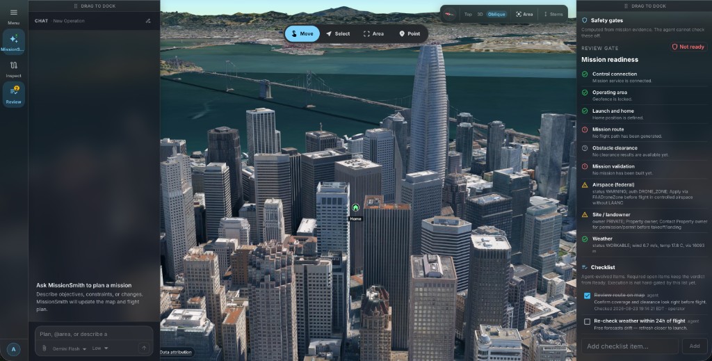
Chat — New Operation
Plan revised
Plan, @area, or describe a change
Gemini FlashSafety gates
Not ready
Computed from mission evidence. The agent cannot check these off.
Mavic 3E
DJI · 45 min · 15 m/s
Copilot
MissionSmith takes the objective, puts a plan on the map, and revises it when the site changes.
Inspection
Gates, stand-off, and blocked segments stay visible. Nothing exports until you accept the plan.
Tell Copilot the job, the site, and the aircraft. It gathers the operating picture and writes the route, cameras, and checks on the map — so you inspect one mission instead of assembling it manually in a planner.
How MissionSmith builds a missionJob
Inspect the exhibition roof. Full coverage on every bay.
Site
Convention hall roof · skylight array
Aircraft
Mavic 3E · 45 min
Copilot writes the route
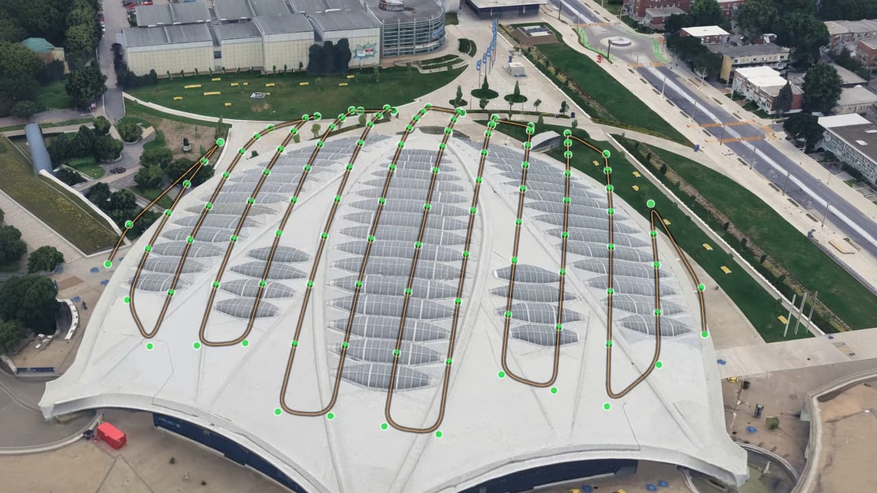
One mission
Review before you accept
Most agents read documents, write code, or call APIs. MissionSmith inspects a 3D environment, constructs a route, evaluates spatial relationships, and validates the result — then leaves the decision with you.
Propose
MissionSmith interprets the objective and generates the mission in 3D.
Check
Geometry, aircraft limits, altitude, geofence, and other conditions are checked independently of the LLM.
Decide
The route, warnings, sources, and unresolved gates remain visible before the mission moves on.
I stopped rebuilding the same facade route by hand. I describe the stand-off, see the conflict on the east face, and decide before anyone is on site.
Ajay S.
Founder at Agmay Technologies
Clearance and readiness stay next to the path. We argue about the gate, not which spreadsheet is current.
Ranjit
Agmay Technologies
The agent handles the first draft and the messy reroutes. We review on the map, assign the gates, and ship when the plan is actually ready.
Sam T.
Mission planner, infrastructure survey
Students see a plan on a photorealistic map in one session. The mission has to earn approval, not just look complete.
Elena V.
Instructor, drone pilot academy
We used to export a path and hope the field agreed. Now the field sees the same geometry we argued about in the office.
Chris P.
Operations manager, solar survey
Stand-off, overlap, and the tight segment show up before I waste a sortie. That alone paid for the early-access time.
Priya N.
Remote pilot, commercial inspection
Natural language gets us to a first draft fast. Validation is what makes it shippable.
Alex M.
UAS coordinator, municipal GIS
We used to split a mission across three tools. Now the route, camera, and clearance live in one place until we're ready to fly.
Dana L.
Aerial director, production unit
Hazard offset for perimeter recon finally feels reviewable. The route stays outside the danger while the recovery plan stays in frame.
Omar H.
Flight lead, wildfire recon support
Composite quotes from early-access operators.
Talk to the agent in plain language. It builds a simple or complex mission as needed — with the route, clearance, and reasoning on the map so you can review before anyone flies.